
Making Wireless IoT Project Easy, Smart, Secure.
GET A FREE SAMPLEIdeal for UAVs, precision agriculture, intelligent driving, vehicle navigation and other scenarios
High-precision positioning serves as the core capability for UAV aerial survey, precision agriculture, intelligent driving and related applications. Traditional RTK solutions normally require an external antenna, which increases installation footprint and wiring complexity. Poor antenna matching also frequently degrades overall performance. Is there a way to retain high positioning accuracy while simplifying system design and boosting integration? The SKM7506T L1+L5 Quadrifilar Helix Antenna RTK Positioning Module delivers an optimal solution. It integrates a high-performance quadrifilar helix antenna and RTK positioning engine into a single unit, supporting dual-band reception across all satellite constellations. With centimeter-level accuracy, low power consumption and compact form factor, it acts as a high-integration, high-performance positioning core for UAVs, precision agriculture, intelligent driving and vehicle navigation.
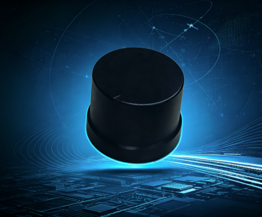
For UAV aerial survey, high-precision positioning guarantees mapping quality, yet external antennas add weight and installation complexity. Autonomous tractors in precision agriculture require centimeter-level positioning, but separated antenna-receiver architectures bring cumbersome wiring and susceptibility to interference. Intelligent driving and vehicle navigation systems demand continuous and reliable positioning under harsh environments such as urban canyons and tree shade. In addition, conventional RTK modules consume relatively high power, shortening UAV flight time and introducing thermal issues for on-board systems. Featuring integrated quadrifilar helix antenna design, L1+L5 dual-band reception and low-power architecture, SKM7506T systematically addresses these pain points.
The module embeds a high-performance quadrifilar helix antenna together with an RTK positioning engine. Centimeter-level RTK positioning is available without external antennas. The quadrifilar helix antenna features excellent circular polarization and wide beam coverage, enabling stable reception of low-elevation satellite signals. Reliable signal acquisition is maintained even when UAVs bank during flight or vehicles run over bumpy roads.
The module supports L1 band (GPS L1, BeiDou B1I/B1C, Galileo E1, QZSS L1, GLONASS G1) and L5 band (GPS L5, BeiDou B2A, Galileo E5, QZSS L5, IRNSS L5). Dual-band operation effectively mitigates ionospheric delay errors. Compared with single-band modules, it delivers markedly improved positioning accuracy and anti-multipath capability in urban canyons and shaded areas.
Under RTK fixed solution mode, horizontal positioning accuracy reaches 1.0cm+1ppm and vertical accuracy reaches 1.5cm+1ppm. Standalone positioning: horizontal 1.0m (CEP), vertical 2.0m (CEP). Velocity accuracy: 0.05m/s. RTCM3 differential input is supported, compatible with CORS networks or self-built base stations.
Supports GPS, BeiDou (including BeiDou-3), GLONASS, Galileo, QZSS, IRNSS and SBAS augmentation systems. 200 tracking channels ensure sufficient satellite visibility anywhere globally. AGNSS assisted positioning is available: cold start 28s, hot start only 1s.
Power consumption is merely 60mA @ 3.3V under continuous L1+L5 dual-band operation, well suited for battery-powered devices such as UAVs sensitive to power budget. Two sleep modes are supported: wakeup via serial command and power control wakeup. A built-in supercapacitor sustains backup pin power supply for approximately 1 hour.
Module dimension: 48.0mm × 48.0mm × 42.0mm with lightweight design. Equipped with JST 8PIN locking connector (1.25mm pitch). Interfaces include UART and I2C for seamless connection with flight controllers and on-board hosts. Compatible with standard NMEA0183, NAV-PVT and RTCM3 differential protocols. Data update rate configurable from 1Hz up to 20Hz.
High-precision positioning for UAVs: Integrated antenna design reduces airframe weight and simplifies installation. Centimeter-level RTK accuracy supports control-point-free mapping for aerial survey and precision plant protection operations. Precision agriculture: Delivers centimeter-level positioning for autonomous tractors and variable-rate fertilization. Dual-band anti-occlusion capability works reliably at field edges with partial signal blockage. Intelligent driving: Dual-band RTK and low-power profile meet high-precision vehicle navigation requirements and maintain stable positioning within urban canyons. Vehicle high-precision navigation: Accepts RTCM3 differential data and connects to CORS stations to realize lane-level navigation.
SKYLAB provides complete reference designs, hardware interface documents and technical support for SKM7506T. Firmware upgrade and parameter configuration are supported. Customization of output protocols, refresh rates and serial baud rates can be done according to project requirements. Evaluation kits are available for customers to validate RTK performance in real environments. The integrated quadrifilar helix antenna eliminates antenna matching and tuning work, greatly shortening product development cycles.
The SKM7506T L1+L5 Quadrifilar Helix Antenna RTK Positioning Module combines dual-band global constellation reception, centimeter RTK accuracy, built-in antenna integration and low power consumption. It serves as a high-integration, high-performance positioning core for UAVs, precision agriculture, intelligent driving and vehicle navigation. It enables UAVs to achieve centimeter-level positioning without external antennas, helps precision agricultural equipment simplify installation while retaining operational accuracy, and delivers reliable, easy-to-adopt positioning services for all devices requiring high-precision location.
Prev:AGV UWB Following Solution | Centimeter-Level Industrial AGV Tracking
Next:Time as Scale: The Principle and Error Analysis of UWB TWR Two-Way Ranging
Copyrights© Shenzhen Skylab Co.,LTD All Rights Reserved.


