Making Wireless IoT Project Easy, Smart, Secure.
GET A FREE SAMPLEIn recent years, coal mine tunnel construction personnel around the world occurred accidents often. Therefore, it is very important to track and locate the personnel working in coal mine tunnels.
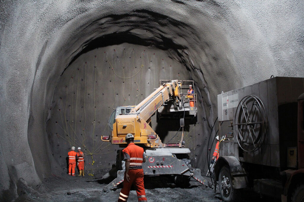
SKYLAB can provide Bluetooth positioning system solution for coal mine tunnel personnel. The positioning system is based on Bluetooth communication technology and computer technology. It can realize the data collection and positioning of mine personnel and equipment.
Install Bluetooth beacons on workers' helmets or other equipment. Bind the Bluetooth beacons and miners' identity information together.
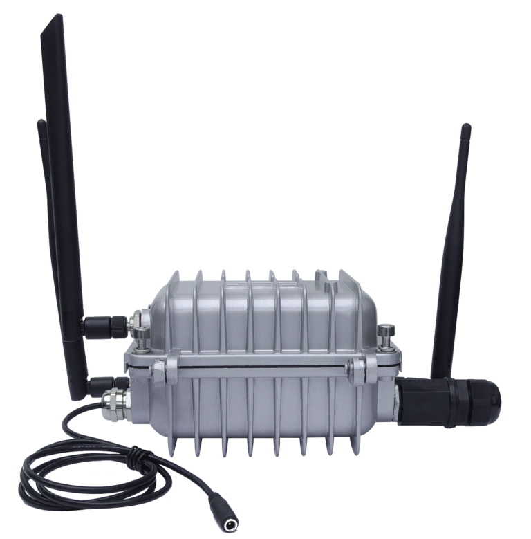
Deploy Bluetooth dowel gateways at important locations in the mine. It can receive signals sent by Bluetooth beacons.
The system processes Bluetooth signals and collects information such as time difference of signal propagation and signal strength. It can calculate the current position of the worker.
The system transmits the positioning results to the monitoring server via Bluetooth or wireless network. The map will display the worker's location information in real time.
The Bluetooth positioning system can determine the miner's identity and the time of entering the mine. It can also realize mine tunnel personnel positioning, dispatching and rescue. Bluetooth positioning system has the advantages of high positioning accuracy and low positioning cost.
Bluetooth signal propagation characteristics are affected by obstacles, reflections, attenuation and other factors in the environment. Therefore, in different environments, the propagation distance and strength of Bluetooth signal will be different.
RSSI is the strength of the received Bluetooth signal. It can determine the distance and direction of the device from the Bluetooth signal source by RSSI value.
Arrange multiple Bluetooth gateways in the mine. It can determine the location of each Bluetooth beacon by collecting RSSI values from different locations.
Collect the location information of Bluetooth signal sources in different locations. The system can create a map of the mine to realize the positioning of people in the mine.
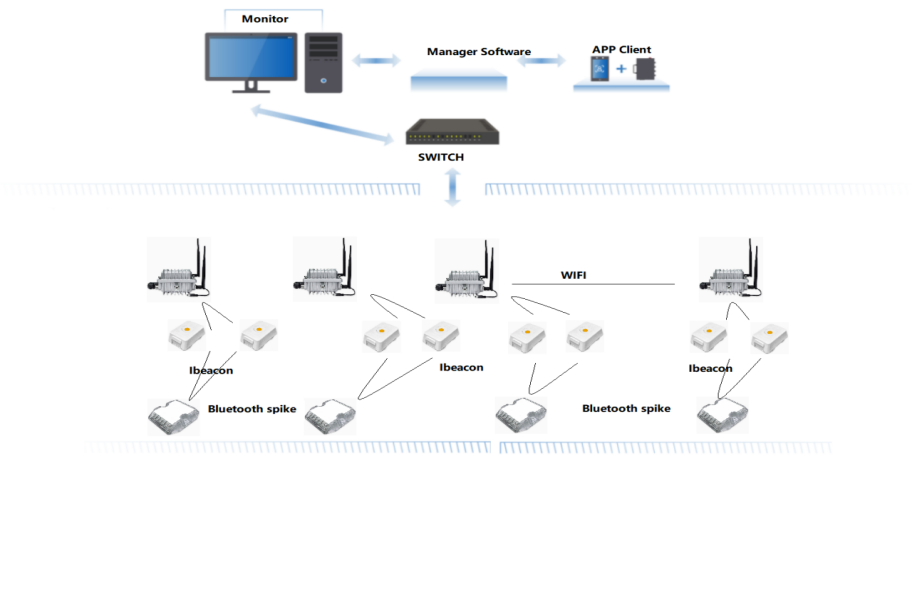
Bluetooth positioning system includes personnel and equipment positioning, monitoring, querying, data uploading and control center. The overall system architecture consists of the following parts.
Each mine personnel head-mounted equipment installed Bluetooth beacon tags. Bluetooth spike gateway is mounted on the wall. Bluetooth beacon and Bluetooth gateway base station form the data acquisition system. It collects the real-time mine personnel positioning data and transmits it to the gateway in a timely manner.
When the mine personnel enters the gate, it can automatically locate the mine personnel through the Bluetooth positioning system. It can automatically recognize the mine personnel ID information through the Bluetooth positioning system. The system automatically uploads the mine personnel positioning information through the network.
The Bluetooth beacon calibrates the location information of the personnel under the mine. It forms asset identification and location identification at the server side.
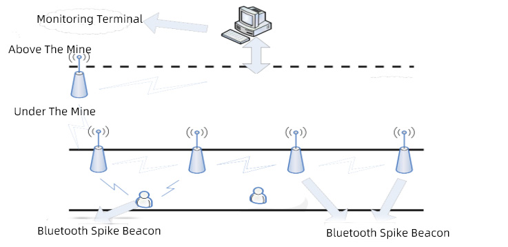
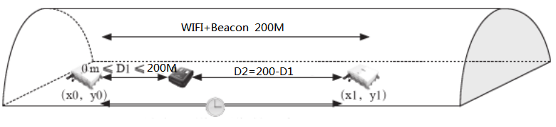
Use high-power WIFI bridge to build data transmission from underground to surface. It can realize wireless communication in underground mine. The wireless bandwidth rate is 300M bps and the coverage distance is 200 m. It can effectively provide underground to surface data transmission.
Vector map includes two kinds of 2D plane map and 3D three-dimensional map. It displays a comprehensive overview of the mine. The system marks the location information of mine personnel.
The data from the acquisition layer is processed by local Bluetooth positioning beacons. The background processing of the server gets the real-time location data of the mine personnel.
According to the vector map data, combined with the Bluetooth positioning data. The system can realize accurate positioning of mine personnel.
The data management platform includes map management, personnel management, charging pile management, whitelist management, abnormality information and status management.
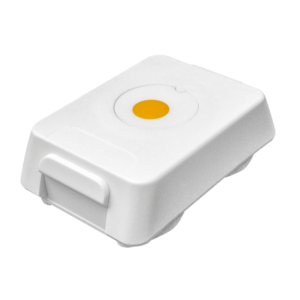
VDB1506 can be installed and fixed on the safety helmet, and can also be fixed on the equipment.
◆Wireless distance: 3-30m
◆Material: Plastic ABS+PC
◆Waterproof: iP67
◆Installation method: screw fixing, 3M glue, hanging
◆Working temperature: -20°-+70°
◆Equipment installation: buckle
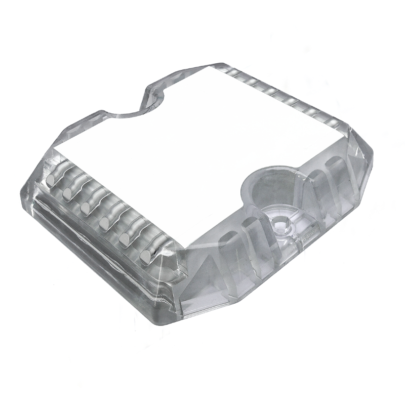
◆Power supply: battery
◆Installation height: less than 10 meters
◆Coverage radius: 1.5 times the hanging height
◆Waterproof: iP67
◆Installation method: top, ground, wall
◆Battery life: 3 years
◆Installation height: according to the actual situation
◆Coverage distance: 200m
◆Rate: 300M bps
◆Waterproof grade: IP67
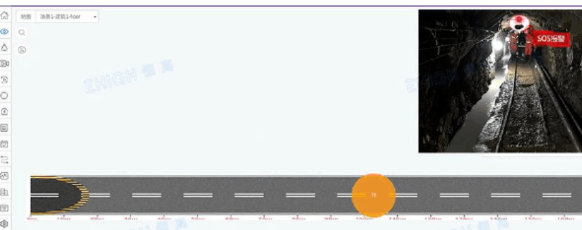
The modeling data is a variety of two-dimensional planes and three-dimensional planes. It is used to display locating personnel and device location information.
It records personnel information, transportation equipment information, and fixed reference object information. The Bluetooth beacon cooperates with the fingerprint information of the Spike base station to determine their respective positions.
Bluetooth spikes are used inside mines. It covers a distance greater than 20m.
It can realize WIFI bridge and complete the communication layer access from underground to ground.
The Bluetooth gateway receives the data from the Bluetooth beacon worn by the person. It is uploaded to the ground service center via WIFI.
Copyrights© Shenzhen Skylab Co.,LTD All Rights Reserved.


