Making Wireless IoT Project Easy, Smart, Secure.
GET A FREE SAMPLEIn applications such as precision drone operations, high-precision vehicle navigation, and handheld RTK surveying, positioning accuracy and reliability directly determine the core value of the device. Traditional single-band, single-system modules are prone to ionospheric delay and multipath effects in complex environments, resulting in noticeable positioning jitter that fails to meet centimeter-level requirements. On the other hand, high-end multi-band RTK modules are often bulky and power-hungry, limiting their use in compact devices. How can you achieve dual-band, multi-system, centimeter-level RTK positioning under the constraints of small size and low power consumption? The SKG12MR-06A dual-band full-constellation RTK module delivers the ideal answer.
The SKG12MR-06A meets these demands with dual-band, full-constellation reception and RTK technology.
The module supports both L1 and L5 bands, covering the following satellite systems:
With up to 200 tracking channels, it provides abundant satellite signals anywhere in the world.
Supports RTCM 3.x differential data via UART interface, compatible with CORS stations or self-built base stations.
Maintains fast positioning and continuous tracking even under weak signal conditions (e.g., tree shade, between buildings).
Ideal for battery-powered devices such as drones and handheld terminals.
| Parameter | Value |
|---|---|
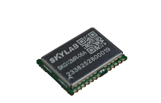
| Dimensions | 16.4 mm × 12.2 mm × 2.4 mm |
| Package | SMD, compatible with mainstream GNSS modules |
| Frequency Bands | L1 + L5 |
| Supported Systems | GPS (L1/L5), BeiDou (B1I/B1C/B2A), Galileo (E1/E5a), QZSS (L1/L5), GLONASS (G1), SBAS (L1), IRNSS (L5) |
| Tracking Channels | 200 |
| Single-Point Accuracy | Horizontal ≤ 1.0 m CEP, Vertical ≤ 2.0 m CEP |
| RTK Fixed Accuracy | Horizontal ≤ 1 cm + 1 ppm, Vertical ≤ 1.5 cm + 1 ppm |
| Velocity Accuracy | 0.1 m/s |
| PPS Accuracy | < 20 ns |
| Cold Start | ≤ 28 s |
| Hot Start | ≤ 1 s |
| AGPS Start | ≤ 1.5 s |
| Tracking Sensitivity | -165 dBm |
| Re-acquisition Sensitivity | -159 dBm |
| Cold Start Sensitivity | -148 dBm |
| Hot Start Sensitivity | -159 dBm |
| Power Consumption | 40 mA @ 3.3 V (continuous L1+L5) |
| Main Voltage | 1.8 V – 3.6 V (Typ. 3.3 V) |
| Backup Voltage | 1.8 V – 3.6 V |
| Operating Temperature | -40°C to 85°C |
| Interfaces | 2× UART (default 115200 bps, max 6 Mbps), PPS, I²C, GPIO |
| Protocols | NMEA-0183, RTCM 3.x |
SKYLAB provides complete reference designs, layout guides, and technical support for the SKG12MR-06A to help customers accelerate hardware integration and antenna matching. The module supports firmware upgrades and parameter configuration, with custom output protocols, refresh rates, and sleep strategies available upon request. Evaluation kits are also available for real-world RTK performance testing.
The SKG12MR-06A dual-band full-constellation RTK positioning module packs flagship performance – L1+L5 dual-band, multi-constellation, centimeter-level RTK – into a tiny 16.4 × 12.2 mm footprint. It allows drones to operate confidently over urban areas, autonomous vehicles to navigate precisely in complex traffic, and every high-precision device to rely on a robust “positioning heart.”
Prev:Anti interference antenna for unmanned aerial vehicles
Next:Intelligent positioning wearable watch for global protection
Copyrights© Shenzhen Skylab Co.,LTD All Rights Reserved.


