Making Wireless IoT Project Easy, Smart, Secure.
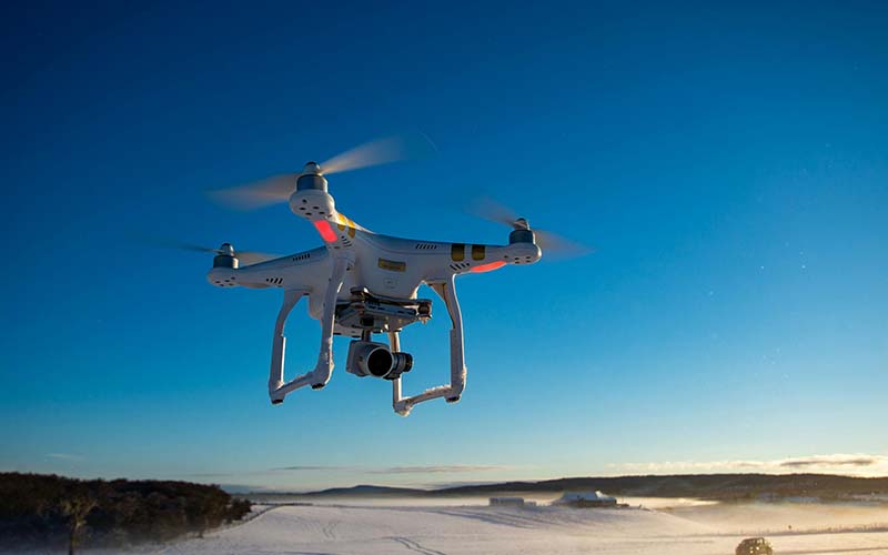
GET A FREE SAMPLEIn recent years, drones have evolved from niche hobbyist tools to powerful devices that are integral to various industries, ranging from agriculture and surveying to media production and disaster management.
The Global Positioning System (GPS) has become the core pillar of modern unmanned aerial vehicle (UAV) technology, completely transforming the application scope and capability boundaries of UAVs. From the initial simple position reference to the current intelligent flight center, GPS technology has enabled UAVs to achieve a qualitative leap from "remote-controlled toys" to "intelligent aircraft".
The principle of drone positioning: The GPS module of the drone receives signals from at least 4 satellites to calculate the three-dimensional position (longitude, latitude and altitude) and time information. Modern consumer-grade drones usually use GPS receivers with an update rate of 20Hz, which can achieve 20 position refreshes per second, providing real-time data support for flight control. It supports multi-system fusion positioning. Currently, mainstream drones have achieved compatibility with multiple satellite systems, and the collaborative operation of multiple systems can increase the number of available satellites from 12-15 in a single GPS to more than 30, significantly improving positioning reliability and accuracy, especially in complex environments such as urban canyons.
The real-time dynamic positioning (RTK) technology, through correction by ground-based enhancement stations, can enhance the positioning accuracy of unmanned aerial vehicles from the ordinary GPS's 2-5 meters to 1-2 centimeters. By using PPK post-processing for dynamic positioning, high precision can be achieved without relying on real-time data links. By using the above technologies, its high-precision positioning function can be achieved.
GPS, or the Global Positioning System, is a satellite-based navigation system that provides location data to receivers anywhere on Earth. It relies on a network of satellites that send out signals to GPS receivers, which then calculate their position based on the time it takes for the signals to travel from the satellites to the receiver.
In the context of drones, GPS plays a crucial role in enabling precise positioning and navigation. A drone equipped with a GPS receiver can determine its latitude, longitude, and altitude with remarkable accuracy. This information is vital for controlling the drone’s movements and ensuring that it reaches its intended destination.
However, the role of GPS in drone technology goes beyond basic navigation. Advanced GPS systems, coupled with other sensors such as accelerometers, gyroscopes, and magnetometers, allow drones to perform intelligent flight operations such as waypoint navigation, obstacle avoidance, and automated return-to-home functions.
GPS technology has become the core enabling technology for the intelligent flight of unmanned aerial vehicles. From basic positioning to advanced autonomous flight, its importance is self-evident. With the popularization of RTK/PPK technology, the deepening of multi-system integration, and the emergence of new technologies, the positioning capability of unmanned aerial vehicles will continue to improve, laying a solid foundation for broader and more intelligent application scenarios. In the future, the deep integration of GPS with other perception and navigation technologies will drive unmanned aerial vehicles to continuously develop towards complete autonomy, opening a new era of intelligent aviation.
Prev:How LoRaWAN Builds a True Smart City
Next:SKU623 UWB Module: 2500-meter Precise Positioning for Drones
Copyrights© Shenzhen Skylab Co.,LTD All Rights Reserved.


